Wednesday, July 29, 2015

General Land Office and Laguna Madre

General Land Office
Laguna Madre
July 22, 2015


We started our final field trip at the General Land Office.  I learned so much.  I had seen this office on my way to and from work, but had never stopped to look at the sign.  I realized that they are the people responsible for keeping our waters safe from oil spills.  They explained to us the different types of material that are considered spills and the different ways in which they clean them.

This office is on the Bahia Grande-Brownsville Ship Channel Sub Watershed.  It then flows to the Brownsville Ship Channel Watershed and continues its way to the South Laguna Madre River Sub Basin making its final flow into the Nueces-Rio Grande Coastal Basin River Basin.

I thought that each section of Brownsville would have a different sub watershed, but after looking at the Texas Parks and Wildlife Watershed Viewer, I realized that most of Brownsville is in the same watershed system.


Our final stop in our journey through the watershed system was at Laguna Madre.  Here we were able to see the pristine condition of the water and the overall environment.

It is located on the Brownsville Ship Channel Watershed then flows into the Bahia Grande-Brownsville Ship Channel Sub Watershed.  It continues to the South Laguna Madre River Sub Basin and finally makes its way to the Nueces-Rio Grande Coastal Basin River Basin.


Palmetto Hill, Mouth of the River and South Jetties

Palmetto Hill
Mouth of the River
South Jetties
July 21, 2015


Palmetto Hill was the site of the last battle of the American Civil War.  I was not aware that there had been a battle of the civil war in the valley.  For some reason, I thought that all the battles for the civil war had been held north of the valley.  I learned a very valuable lesson.

Palmetto Hill is in the Outlet Rio Grande Sub Watershed.  It then flows into the Outlet Rio Grande Watershed and continues flowing to the Lower Rio Grande River Sub Basin and finally empties into the Rio Grande River Basin.


At the mouth of the river, we found out that the there is silt not sand and that there is no sand on the Boca Chica Beach, this too is silt.  This is the end of the river where it runs into the ocean.

The mouth of the river is in the Outlet Rio Grande Sub Watershed.  It follows its flow into the Lower Rio Grande River Sun Basin.  It finally flows into the Rio Grande River Basin.


At south jetties we see blocks of marble.  These blocks create niches for different sea life.

This area belongs to the Bahia Grande-Brownsville Ship Channel Sub Watershed.  It continues its flow to the Brownsville Ship Channel Watershed.  Then it goes into the South Laguna Madre River Sub Basin and finally flows into the Nueces-Rio Grande Coastal Basin River Basin.


Dr. Garcia then led us to an area he calls the high ground.  It was scary to see all the cars go up the vertical road towards a type of levee with a narrow road.  From this vantage point, we could look towards the water and find mangrove and sea grasses, but as you turned around the opposite side had very different vegetation.


Tuesday, July 28, 2015

Drive Along the Border and Sabal Palm

Drive Along the Border
Sabal Palm
July 20, 2015


Driving along the border, we see the levees that have been built near the Rio Grande River to control its flow.  


At Sabal Palm we were able to get on a deck to observe the Rio Grande River.  The Rio Grande River flows to the Outlet Rio Grande Sub Watershed and continues to the Outlet Rio Grande Watershed.  It then flows to the Lower Rio Grande River Sub Basin.  Finally it empties into the Rio Grande River Basin.


We further learned that Mr. Rabb built the plantation next to the Rio Grande River.  He wanted everyone to see his house from the river and he wanted to see the boats passing by.  However; he did not know that with each rainy season the direction of the river changed.  Since the river was the marker to determine the border, the border              changed every time the river changed direction.  The river continued to change                
   directions and eventually did not flow in front of the Rabb house.  He decided to dig a
   canal to have water go into the area where the river had been before.  The
   Rio Grande River was later controlled with dams and levees and geographic markers
   were set to have a definite and never changing border.

Sabal Palm is on the Bahia Grande-Brownsville Ship Channel Sub Watershed.  It continues to flow to the Brownsville Ship Channel Watershed then it flows into the South Laguna Madre River Sub Basin and empties into the Nueces-Rio Grande Coastal Basin River Basin.

Sunday, July 26, 2015

Palo Alto Battlefield and Laguna Atascosa NWR Headquarters

Palo Alto Battlefield 
Laguna Atascosa National Wildlife Refuge Headquarters

I learned that the Palo Alto Battlefield National Historic Site is located on high ground.  It is interesting how we take it for granted that this battle was won, but we never take the time to analyze why it was won, the events that assisted or the use of the landscape as an advantage to win the battle.  It was amazing to learn that the salt in the ground helped American soldiers win the battle. 

This site is on the Brownsville Ship Channel Watershed.  It then flows into the Bahia Grande-Brownsville Ship Channel Sub Watershed.


I learned that this area and many others in the Rio Grande Valley that have water will have Spartina. Many different types of fish such as Red fish go into the Spartina looking for fiddler crabs to feed on.


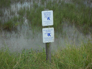
I came across this sign and thought how wonderful it was that there are areas that are restricted.  I thought that in a wildlife refuge visitors were allowed to go anywhere they would like to investigate.  I never stopped to think that the purpose was not only for us to have the opportunity to see these beautiful animals in their natural habitat, but also to make them feel comfortable in the habitat and continue to frequent the area.  If we were allowed to go into these areas, the probability that these animals would return would be low due to our intrusion on their habitat.

Laguna Atascosa has two sub watersheds one is the Laguna Atascosa and the other is the Bahia Grande-Brownsville Ship Channel.  These flow into the Laguna Atascosa and Brownsville Ship Channel Watersheds.  The flow continues to the South Laguna Madre River Sub Basin and ending with the Nueces-Rio Grande Coastal Basin River Basin.


Estero Llano and Rio Hondo

Estero Llano Grande State Park
Low Water Bridge
Rio Hondo 
July 15, 2015


Our day started by visiting Estero Llano Grande State Park.    The stay at the park was short, but we were still able to follow some of the short trails and saw the beautiful landscape.  

Estero Llano Grande State Park has two sub watersheds one is the Upper Pilot Channel-Laguna Madre the other is the Llano Grande Lake-Arroyo Colorado.  They flow into two watersheds the first is the Upper Pilot Channel-Laguna Madre the other is the Upper Arroyo Colorado.  These then flow into the South Laguna Madre River Sub Basin.  It then flows into the Nueces-Rio Grande Coastal Basin River Basin.


We continued to see the flow of the river at the Low Water Bridge.  At this particular point there was minimal to no current.


Our last stop was at Rio Hondo to see the vertical lift bridge over the Arroyo Colorado. This area is part of the Line V Canal-Arroyo Colorado Sub Watershed.  It then flows into the Lower Arroyo Colorado Watershed.  From there, it continues to flow to the South Laguna Madre River Sub Basin then into the Nueces-Rio Grande Coastal Basin River Basin.


At the bottom of these columns, we were able to see a sheepshead fish eating the barnacles.  Many mullets were swimming along the bank.   

Los Ebanos Ferry and Roma Bluffs


Los Ebanos Ferry
Santa Cruz de Rio Grande City
Roma Bluffs
July 14, 2015


The first stop in our journey was to the Los Ebanos Ferry.  I did not know that we had a hand operated ferry in our area.  This is where I learned what a cut bank was.  I would call it a cliff, but have learned the correct term.  It was interesting to see the level of the water and the force of the current. We realized that the U.S. side can handle a rise in the water level in this area, but not on the Mexico side.  If flooding would occur, the water would flood many homes that are close to the river. 

Los Ebanos is located in the La Burrita Creek-Rio Grande Sub Watershed.  It flows into La Joya Creek-Rio Grande Watershed; which flows into the Los Olmos River Sub Basin.


We continued on our way to Rio Grande City.  This is where we were able to see higher elevation. Homes were built on small hills.  It was interesting to see how the hills have been cut through to make roadways.  This retaining wall is a display of the modifications that had to be made to the natural landscape to create our roadways.


Santa Cruz de Rio Grande City was very impressive.  I wasn't sure I was going to make it all the way up.  It is quite a site as you come into the parking lot and look up toward the cross.


I was not aware that this was limestone and that it does not erode but it dissolves with acid.


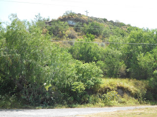
The view from atop the hill is beautiful.  It gives us an understanding of the altitude of the land in the past.  It is almost unbelievable that so much of the land has eroded leaving only the hill behind.

Rio Grande City is part of the Rio Grande City-Los Olmos Creek Sub Watershed.  Rio Grande City is also in the Kelsey Lake-Rio Grande Sub Watershed.  It then flows into Arroyo Grande-Rio Grande Watershed and Los Olmos Creek-Rio Grande Watershed; which then flows into the Los Olmos River Sub Basin.


Our last stop was at the Roma Bluffs.  To begin with I did not know the word bluff let alone know the meaning of the word.  I now know that it's a high vantage point.  The view from the bluff was beautiful.  I had heard that there were small islands revealed by the low level of the water on the river, but I had never been able to witness this.

Roma is located in an area with several sub watersheds.  It begins with the Ramirez Creek-Rio Grande Sub Watershed followed by the Arroyo Morenos-Rio Grande Sub Watershed, then there is the Arroyo La Minta Sub Watershed finally there is the Arroyo Garceno-Arroyo Grande Sub Watershed. The sub watersheds flow into the Arroyo Grande-Rio Grande Watershed.  This then flows into the Los Olmos River Sub Basin.